20 Best GIS Software Applictions 2025
What is GIS
GIS stands for Geographic Information System, a software-based system designed to collect, manage, analyze, and visualize spatial and geographic data. GIS technology is used across various industries, including urban planning, environmental management, transportation, and public health. It aids in decision-making by integrating different data sources and providing location-based insights
20 Best GIS Software with Applications in 2024 Commonly used GIS software includes:
1. ArcGIS ArcGIS, developed by Esri, stands as a comprehensive geospatial platform widely recognized for its world-leading capabilities in creating, managing, analyzing, mapping, and sharing diverse types of data.
It is utilized by a significant majority of the largest global companies and national governments, highlighting its pivotal role in essential business and governmental operations. ArcGIS seamlessly integrates with CAD functionalities through products like AutoCAD Map 3D, allowing users to work with both design and geospatial data within a unified environment for planning, design, and management purposes.
The platform supports the analysis and visualization of data in 2D, 3D, and even real-time, enabling advanced insights into spatial and temporal patterns. Its robust suite of spatial analytics and data science tools empowers users to analyze patterns, discover locations, perform proximity analysis, enrich data, and even leverage deep learning for advanced feature categorization and object detection. ArcGIS extends its capabilities to mobile and field operations, providing applications for data collection, workforce planning, and routing, even in disconnected environments.
Furthermore, its integration with ArcGIS Living Atlas of the World provides users with immediate access to an extensive collection of geographic information, including maps, apps, and data layers.
ArcGIS operates on a subscription-based pricing model, offering various editions such as Viewer, Editor, Creator, and GIS Professional Basic and Advanced, each tailored to different user roles and functionalities. Licenses are also available for personal, student, and educational use at reduced costs, promoting accessibility for learning and non-commercial projects .
The annual cost for ArcGIS can range from $100 to $3,800 for individual licenses, while enterprise-level solutions can reach up to $165,000, with the average annual expenditure being around $27,000. ArcGIS Online also offers pay-as-you-go options for certain services, providing flexibility for users with fluctuating needs.
The primary target audience for ArcGIS spans a wide array of industries, including government (for fund distribution and public safety), business (for market analysis and supply chain management), environmental science (for resource management and conservation), urban planning (for city development and infrastructure), and infrastructure management (for asset tracking and network analysis). It is primarily used by GIS professionals, analysts, and decision-makers who require a comprehensive platform for complex geospatial tasks. The Business Analyst module specifically targets professionals in marketing, real estate, and site selection, offering specialized tools for market analysis and customer profiling.
Esri provides a 21-day free trial of ArcGIS Online, allowing potential users to explore its capabilities. Additionally, ArcGIS for Personal Use and ArcGIS for Student Use are available at reduced subscription fees for non-commercial purposes
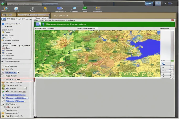
2. QGIS QGIS (Quantum GIS) is a robust, user-friendly, and feature-rich open-source GIS software that provides a powerful platform for viewing, editing, and analyzing geospatial data. It boasts the capability to handle a multitude of database functionalities and formats, supporting both vector and raster data in various projections without requiring any data conversion.
QGIS’s functionality can be extensively customized and expanded through a vast library of over 2000 plugins and its support for Python scripting, allowing users to tailor the software to their specific needs. It offers a comprehensive suite of tools for vector analysis, sampling, geoprocessing, geometry manipulation, and database management, providing core GIS functionalities essential for spatial data analysis. Furthermore, QGIS seamlessly integrates with GRASS GIS, enabling access to the complete range of GRASS’s over 400 modules for advanced geospatial processing. The software also features 3D visualization and modeling capabilities, allowing users to explore and analyze data in three dimensions
QGIS operates under the GNU GPLv2+ license, making it a free and open-source software accessible to everyone without any licensing fees. For users requiring hosted solutions and additional features, QGIS Cloud offers paid plans that include options for restricted access, SSL support, and extra storage and databases.
The software has also gained significant popularity in countries such as Greenland, Iceland, Portugal, Australia, Spain, Germany, Austria, and Poland.
3. GRASS GIS GRASS GIS (Geographic Resources Analysis Support System) is a powerful, free and open-source GIS software suite renowned for its capabilities in geospatial data management, analysis, and modeling. It is adept at handling a wide array of geospatial data, including raster, topological vector, image processing, and graphic data. GRASS GIS boasts a vast collection of over 500 modules designed to perform tasks ranging from simple data manipulation to advanced spatial analysis and modeling. The software offers both an intuitive graphical user interface (GUI) for ease of use and a command-line interface that is preferred by power users for automation and production workflows. Its advanced spatial analysis functionalities include robust tools for terrain analysis, hydrological modeling, network analysis, and comprehensive image processing. GRASS GIS also integrates seamlessly with QGIS, providing users with flexible options for geospatial analysis and visualization.
GRASS GIS is distributed as free and open-source software under the terms of the GNU General Public License (GPL >= v2), ensuring its accessibility and allowing for community-driven development and use without any cost.
The primary target audience for GRASS GIS includes researchers, developers, and GIS professionals who often require extensive analytical capabilities and are comfortable with a steeper learning curve associated with its command-line focus. It is ideally suited for applications in spatial modeling, advanced geoprocessing, environmental analysis, urban planning, and various academic and research settings. GRASS GIS is also a strong consideration for organizations that are evaluating the implementation of open-source GIS software solutions to meet their specific requirement.
4. Map Info Professional MapInfo Professional, developed by Precisely, is a well-established desktop geographic information system (GIS) software utilized for comprehensive mapping and in-depth location analysis. This all-in-one solution empowers users to effectively manage, analyze, visualize, and confidently act upon location-based data, facilitating the creation and publishing of insightful maps throughout an organization.
MapInfo Professional supports both 2D and 3D geospatial data, enabling a more realistic representation of terrain, buildings, and other spatial objects. It offers powerful spatial querying and modeling tools that allow users to integrate corporate data with maps and demographics to build easily understandable models for informed decision-making.
The software exhibits broad compatibility with various data formats, including ESRI Shapefile, AutoCAD DXF, CSV, Microsoft Excel, and spatial databases like Oracle and PostGIS, ensuring seamless data exchange with other applications. Notably, it also integrates with the Snowflake Data Cloud, allowing users to directly access, edit, and visualize spatial data within this modern cloud environment. To enhance productivity and customization, MapInfo Professional provides robust support for both Python and MapBasic scripting languages, enabling users to build, run, and reuse tailored applications.
5. Google Earth Pro Google Earth Pro is a powerful desktop software application that enables users to explore and visualize the Earth’s surface with remarkable detail, utilizing a vast repository of satellite and aerial imagery. While sharing the familiar interface of the web-based Google Earth, the Pro version offers a suite of advanced tools catering to more professional and analytical needs, These enhanced features include the ability to import GIS data in formats like shapefiles and CSVs, export high-resolution imagery for presentations and reports, utilize advanced measurement tools for area, radius, and 3D paths, and create and export videos of virtual tours.
Users can also search for specific geographic coordinates and download geospatial data in the KML (Keyhole Markup Language) format for use in other GIS applications. A significant advantage of Google Earth Pro is its extensive archive of historical imagery, allowing users to observe and analyze changes to the landscape over time. The software also facilitates the integration of various data sources, enabling the creation of customized maps and overlays with placemarks, polygons, and detailed descriptions.
In a notable shift, Google Earth Pro is now available free of charge for desktop users, making its advanced features accessible without the previous annual subscription fee of $399. It’s important to distinguish Google Earth Pro from Google Earth Engine, which has a usage-based pricing model for its more intensive geospatial analysis capabilities, and Google Maps Platform, which has its own pricing structure for its mapping and location services.
6. Geo Server GeoServer is a widely adopted open-source server designed for the seamless sharing of geospatial data, prioritizing interoperability across diverse platforms. This Java-based server adheres to industry-standard OGC protocols such as Web Feature Service (WFS), Web Map Service (WMS), and Web Coverage Service (WCS), enabling the publication of data from virtually any major spatial data source.
GeoServer exhibits broad compatibility, supporting a wide array of vector data formats, including Shapefiles, PostGIS, ArcSDE, and Oracle Spatial, as well as raster formats like GeoTIFF, JPG, and PNG. Configuration and management are facilitated through an intuitive, browser-based administrative interface. The server also offers on-the-fly reprojection capabilities, ensuring data can be presented in various coordinate systems as required by different clients. To optimize the delivery of map images, GeoServer is integrated with GeoWebCache, which provides efficient tile caching services. Users have extensive control over the visual presentation of their data through support for styling languages such as SLD, GeoCSS, and Mapbox Styles.
As an open-source project, GeoServer is freely available under the GNU General Public License Version 2.0, making it a cost-effective solution for organizations of all sizes. While the core software is free, commercial support, training, and enterprise-level features are offered by third-party providers like GeoSolutions, catering to organizations with more complex needs.
7.) Global Mapper Global Mapper, developed by Blue Marble Geographics, is a versatile and affordable GIS software application designed to provide both novice and experienced geospatial professionals with a comprehensive array of spatial data processing tools. This all-in-one solution boasts unmatched support for over 300 file formats, encompassing vector, raster, elevation, and point cloud data types, eliminating the need for add-ons or additional licenses.
Global Mapper facilitates seamless connection to numerous online data sources for imagery, basemaps, terrain, and vector data, expanding the scope of available geospatial information. It offers flexible data visualization and sharing options, allowing users to export data in any supported format, as well as through screenshots, videos of 3D data, and print-ready map layouts. The software includes a wide range of digitizing tools for creating and editing vector data, along with specialized geometric tools for generating features like range rings and buffer areas. For raster data, Global Mapper provides tools for display, analysis, calculation (including NDVI and custom formulas), blending, feathering, and rectification.
Terrain creation and analysis are also key features, with capabilities for contour generation, line-of-sight calculations, viewshed analysis, watershed modeling, and flood simulation. Users can automate workflows by building Global Mapper Scripts or utilizing the batch processing function for efficient data conversion and analysis.
Global Mapper targets both novice and experienced geospatial professionals across a wide range of industries, including oil & energy, information technology, civil engineering, higher education, and telecommunications. It is well-suited for anyone who deals with maps or spatial data, from those needing a standalone data management tool to organizations requiring an integral component of an enterprise-wide GIS. The software is praised for its intuitive user interface and logical layout, making it accessible to users with varying levels of GIS expertise
8.) Post-GIS PostGIS is an open-source extension that enhances the capabilities of the PostgreSQL relational database system by adding robust support for storing, indexing, and querying geospatial data. This extension transforms PostgreSQL into a powerful spatial database, enabling the efficient management and organization of geographic objects in both vector and raster formats. Key features of PostGIS include support for a wide range of spatial data types (points, lines, polygons, multi-geometries in 2D and 3D), spatial indexing for rapid data retrieval based on location, and an extensive library of spatial functions for filtering, analyzing, and manipulating spatial data (measuring distances, intersecting geometries, buffering).
It also provides tools for geometry processing (simplification, conversion, generalization), raster data support, and functions for geocoding and reverse geocoding. PostGIS exhibits excellent integration with other GIS tools such as QGIS, GeoServer, MapServer, ArcGIS, and Tableau, making it a central component in many geospatial workflows.
9.) ENVI ENVI, developed by NV5 Geospatial, is a premier software suite tailored for advanced remote sensing and image analysis, providing a comprehensive set of tools for extracting meaningful information from geospatial imagery. It enables users to easily perform complex image processing tasks without requiring extensive expertise in advanced image analysis techniques. ENVI supports a wide range of data types from various platforms (satellites, airborne, drones, terrestrial) and modalities (panchromatic, multispectral, hyperspectral, LiDAR, SAR), and it is designed to handle both small and very large datasets efficiently. Key features include tools for data calibration, preprocessing, atmospheric correction, pan sharpening, orthorectification, image registration, anomaly detection, change detection, classification, and feature extraction.
ENVI also offers specialized modules for tasks like DEM extraction, photogrammetry, and SAR data analysis. It provides automated workflows for common image analysis tasks and allows for customization through an API to meet specific project requirements. Notably, ENVI offers seamless integration with the ArcGIS Platform from Esri, allowing users to access ENVI’s image analysis capabilities directly from the ArcGIS environment
10.) SAGA GIS SAGA GIS (System for Automated Geoscientific Analyses) is a free and open-source Geographic Information System (GIS) software designed to provide an efficient and user-friendly platform for (geo-)scientists to implement geoscientific methods. Its modular system architecture is built upon a robust Application Programming Interface (API), facilitating the development and integration of new geoscientific methods bundled as exchangeable module libraries.
SAGA GIS boasts a comprehensive set of tools and functionalities, including file access for various table, vector, image, and grid file formats (including Shapefiles and GDAL-supported formats), gridding and interpolation from vector data, geostatistical analysis, grid and image processing tools, terrain analysis (geomorphometric calculations, hydrological parameters), and vector tools. It also offers a user-friendly graphical user interface (GUI) alongside command-line capabilities, making it accessible to a wide range of users. SAGA GIS can be effectively used in conjunction with other GIS software like QGIS and Kosmo to enhance vector datasets and map production capabilities .
Furthermore, SAGA GIS modules can be executed from within the R statistical software, enabling seamless integration of statistical and GIS analyses. SAGA GIS is a free and open-source software distributed under the GNU General Public License, ensuring its free use, distribution, study, and improvement. As an open-source project, it does not require any licensing fees, making it accessible to anyone interested in geospatial data analysis.
11.) White box GAT Whitebox Geospatial Analysis Tools (Whitebox GAT) is an open-source and cross-platform GIS and remote sensing software package designed primarily for geospatial data analysis and visualization in research and education settings. Distributed under the GNU General Public License, Whitebox GAT offers a comprehensive suite of over 385 tools for spatial analysis on raster datasets, with significant functionality for processing vector (shapefile) and LiDAR (LAS files) data. Key features include GIS tools for cost-distance analysis and buffering, image processing tools for classification and filtering, hydrology tools for DEM preprocessing and watershed extraction, terrain analysis tools for slope and aspect calculations, and LiDAR tools for interpolation and point cloud analysis.
Whitebox GAT is designed to process large raster datasets efficiently and includes some tools that utilize parallel processing to enhance performance. The software is extendable, allowing users to create and add custom tools or plugins using any JVM language, and it supports scripting using Groovy, JavaScript, and Python. A notable aspect of Whitebox GAT is its commitment to software transparency, providing users with the right to view the underlying workings of each tool by offering a “View Code” button that links directly to the relevant source code.
The primary target audience for Whitebox GAT is in research and education, including scientists, researchers, educators, and students in fields such as geomorphometry, hydrology, remote sensing, and general geospatial analysis. It is intended for users who require a platform for advanced geospatial data analysis and visualization, with a focus on transparency and the ability to understand the underlying algorithms. The software has also found applications in the geomatics industry.
12.) gvSIG The gvSIG is a user-friendly, open-source Geographic Information System (GIS) application designed for capturing, storing, handling, analyzing, and deploying various types of referenced geographic information to solve complex management and planning problems. Known for its interoperability, gvSIG supports a wide array of formats, including both vector (SHP, DXF, GML, DWG, DGN, KML) and raster (ECW, JPEG, PNG, GIF) files, as well as databases and remote services. It offers a comprehensive suite of tools for working with geographic data, including query tools, layout creation, geoprocessing functions (buffer, intersection, clip), network analysis, and 3D visualization capabilities. gvSIG is designed to be easily extensible, allowing for continuous improvement and the development of tailor-made solutions through its plugin architecture. It also supports scripting for automation and advanced workflows.
The primary target audience for gvSIG includes professionals and stakeholders in the architecture, engineering, and construction industry, as well as users in urban planning, environmental management, and infrastructure monitoring. It is also widely used in academic education for teaching GIS to students across various course programs due to its ease of operability and growing range of functions. The gvSIG community comprises individuals and entities from universities, enterprises, and public administrations who use, personalize, and contribute to the software’s development.
13.) AutoCAD Map 3D AutoCAD Map 3D, developed by Autodesk, is a specialized toolset included with AutoCAD that provides powerful GIS and mapping functionalities within the familiar AutoCAD drawing environment. This model-based GIS mapping software enables users to directly access, create, maintain, and communicate mapping and GIS information, supporting planning, design, and management workflows by integrating CAD and GIS data. Key features include seamless CAD and GIS data aggregation using Feature Data Objects (FDO) technology, direct editing of geospatial data against various GIS data sources (ESRI SHP, MapInfo, Oracle) using standard AutoCAD commands, application of coordinate geometry (COGO) for accurate geometry creation, and drawing cleanup actions to automate corrections.
The software also offers efficient infrastructure asset design and management through enterprise industry modules, allowing for the conversion of GIS data to intelligent industry models for water, gas, wastewater, and electric utilities. Furthermore, it provides robust capabilities for map creation, analysis, and visualization, including styling and theming, topology building for spatial calculations, and analysis tools for buffers, overlays, and spatial queries. AutoCAD Map 3D also facilitates streamlined data flow between ArcGIS and Map 3D, keeping feature information up to date.
AutoCAD Map 3D primarily targets professionals in the architecture, engineering, and construction (AEC) industry who need to work with both CAD and GIS data for infrastructure projects, urban planning, and environmental analysis. This includes regulatory or AML scientists, geologists, soil scientists, hydrologists, civil or mining engineers, and natural scientists. Training courses are available to equip users with the necessary skills in spatial data management and GIS mapping techniques within the AutoCAD environment.
14.) Bentley Map Bentley Map, developed by Bentley Systems, is a powerful GIS software built upon the MicroStation platform, offering a comprehensive environment for creating, editing, and analyzing 2D and 3D geospatial data. It leverages MicroStation’s robust capture, editing, display, and output capabilities while adding specialized geospatial modeling and interoperability tools.
Bentley Map supports the creation, maintenance, and sharing of intelligent geospatial objects, integrating engineering, geospatial, and reality data from various sources. Key features include seamless mapping, scale-sensitive zoom, support for various geospatial file formats (ESRI SHP, MapInfo TAB), direct referencing and editing of spatial databases (Oracle Spatial, Microsoft SQL Server Spatial, PostgreSQL/PostGIS, Esri File Geodatabase), dynamic labeling, thematic mapping, buffer generation, spatial analysis tools, and advanced map finishing capabilities. It also offers advanced 3D solid modeling and the ability to apply textures to 3D models for enhanced visualization. Bentley Map facilitates interoperability with other GIS formats through direct referencing and export tools, as well as through the Bentley Map FME Extension for broader format support and data conversion workflows.
The primary target audience for Bentley Map includes organizations and professionals involved in planning, designing, building, and managing infrastructure around the world, such as grid operators, (semi-)governments, and contractors. It is designed for GIS specialists, engineers, and surveyors who need to create, manage, consult, and analyze GIS files in a CAD environment. Its applications are centered around infrastructure planning, design, and management, including areas like gas and water networks
15.) Kosmo GIS Kosmo GIS is an open-source desktop GIS application developed by SAIG S.L., built upon the JUMP GIS platform and utilizing well-established free code libraries like Geotools and JTS. Known for its user-friendly interface, Kosmo enables users to explore, edit, and analyze spatial data from various databases, vector files (Shapefile, GML, KML, DWG, DXF), and raster files (TIFF, ECW, MrSID) . It offers advanced editing capabilities, including multiple drawing tools and CAD-style functionalities, along with various snapping modes for precise digitizing. Kosmo supports topology consistency rules and includes tools for topology validation and cleaning.
The software also features a module for advanced printing based on OpenOffice, as well as a PDF printing module. Its functionality can be further extended through a plugin architecture, allowing for customization for specific purposes. Kosmo also integrates with Sextante libraries for raster and vector analysis.
16.) CARTO CARTO is a leading cloud-based Location Intelligence platform designed for the modern data stack, enabling organizations to leverage spatial data and analysis directly within their cloud data warehouses like BigQuery, Snowflake, Redshift, and Databricks. This platform offers a comprehensive suite of tools for spatial analytics, data visualization, and application development, all running natively on the user’s cloud infrastructure. Key features include a no-code visual workflow design tool (Workflows) with over 100 ready-to-use analysis components, unmatched data visualization capabilities through CARTO Builder for creating interactive maps and dashboards, and a robust set of platform APIs and libraries for accelerated spatial app development.
CARTO also provides an Analytics Toolbox with advanced spatial functions and procedures to enhance the capabilities of cloud data warehouses, as well as a Data Observatory offering access to thousands of vetted public and premium geospatial datasets for data enrichment. Notably, CARTO is introducing AI Agents for maps, currently in public preview, to make interacting with maps more intuitive through natural language interfaces.
CARTO primarily targets data scientists, developers, analysts, and GIS professionals across a wide range of industries, including retail, real estate, logistics, supply chain, marketing, advertising, telecommunications, and finance. It is designed for organizations looking to leverage location intelligence for various use cases such as optimizing delivery routes, improving behavioral marketing, strategic store placements, and enhancing decision-making through spatial data science.
17) Open Layers Open Open Layers is a high-performance, feature-packed, and completely free open-source JavaScript library utilized for creating interactive maps on the web \. This library enables developers to display map tiles, vector data, and markers loaded from virtually any source directly within a web page \. Open Layers supports a wide array of tiled layers from providers like OpenStreetMap, Bing, MapBox, and various XYZ sources, as well as OGC mapping services and untiled layers.
It can render vector data from numerous formats, including GeoJSON, TopoJSON, KML, GML, and Mapbox vector tiles. Leveraging cutting-edge web technologies like Canvas 2D and WebGL, Open Layers is designed to be fast, mobile-ready, and highly performant. Its architectural flexibility allows for easy extension and customization to meet specific application needs. Open Layers boasts excellent browser and device support, including mobile devices and Retina displays, and is accompanied by abundant examples and comprehensive documentation. It also supports all OGC protocols, including WMS, WFS, WMTS, and WPS.
18.) Geo Network Geo Network is an open-source Catalogue service for geospatial data, providing a robust platform for managing and sharing metadata and related resources in Accordance to with standards mandated by the Open Geospatial Consortium (OGC) and ISO Technical Committee 211. This Java-based application enables the creation of online metadata editors, searchable portals, and registries/repositories, facilitating the discovery and access of geospatial resources. Geo Network supports metadata harvesting from other Catalogues and the creation of federations through remote search capabilities. It plays a crucial role in implementing interoperable Spatial Data Infrastructures (SDI) by providing discovery functionalities as per the INSPIRE directive.
The primary target audience for Geo Network includes organizations that manage and provide access to geospatial data, such as government agencies, environmental organizations, research institutions, and data providers. It is designed for individuals and institutions that need to catalogue their spatial databases and cartographic products, making them discoverable to a broader community of users. Geo Network helps to improve collaboration, reduce data duplication, and enhance the consistency and quality of geospatial information.
19.) Open JUMP Open JUMP is an open-source desktop GIS software program designed for the easy viewing and editing of vector-based GIS data, with limited support for raster data visualization. This Java-based application boasts a user-friendly graphical interface comprising a menu bar, main toolbar, layer list, and map view. Key features include the ability to open and display various vector data formats, most notably ESRI shapefiles, and to style these layers for enhanced visualization by adjusting stroke color, fill color, transparency, and adding labels.
Open JUMP provides tools for editing feature geometries within a layer, allowing users to select and modify vertices of point, line, and polygon features. It also supports basic attribute querying, enabling users to select features based on their attribute values. The software is extensible through plugins, and it adheres to Open Geospatial Consortium (OGC) standards such as GML, WFS, and WMS. Open JUMP is a free and open-source software, making it accessible for use without any licensing fees. The project name itself emphasizes its open nature, welcoming contributions from anyone interested in its development.
) Map Window GIS MapWindow GIS is a lightweight, free and open-source desktop GIS application for Windows, designed to enable users to visualize, manage, edit, analyze data, and create printable maps. It offers a user-friendly graphical interface with tools for identifying and selecting features, editing and viewing attributes, on-the-fly projection, print layout, feature labeling, and changing vector and raster symbology. MapWindow GIS supports easy viewing of many vector (ESRI shapefiles, MapInfo, GML) and raster (digital elevation models, aerial photography, Landsat imagery, tile services like OpenStreetMap) formats.
It provides tools for creating, editing, and exporting spatial data using digitizing tools for shapefiles, a georeferencer plugin, and GPS tools for importing and exporting GPX data. The software’s functionality can be extended through a plugin architecture, allowing users to add capabilities for spatial analysis such as map algebra, terrain analysis, and network analysis. MapWindow GIS is built upon ActiveX controls, making it easy to incorporate into MS Office products and custom applications developed in various languages like VB6, C++, C#, and VB.NET. It also supports OGC standards like WMS and WMTS.
The primary target audience for MapWindow GIS includes individuals and organizations seeking a lightweight, easy-to-use, and free desktop GIS solution for Windows. It is suitable for users who need basic GIS functionalities such as data visualization, simple analysis, and map creation, particularly those in the water resources and modeling community, as well as those who need to integrate GIS capabilities into custom Windows applications.
Why GIS Software is Important in 2025
GIS technology continues to evolve and plays a crucial role in various industries, including:
- Urban Planning – Helps design and manage smart cities.
- Environmental Management – Assists in monitoring climate change and conservation efforts.
- Disaster Response – Provides real-time mapping for emergency situations.
- Transportation & Logistics – Enhances route planning and traffic management.
- Healthcare – Supports epidemiological studies and resource allocation.
Read More
20 Sub-disciplines of civil engineering